GARMIN SALES MANAGER KILLED IN AIRPLANE ACCIDENT
My upcoming "170 News" article tells a little about flying in the rapidly-rising terrain near Rich Mtn VOR (just northwest of Mena, AR.) I know a little bit about that area having flown there many times over the years. My upcoming article is not to suggest that anyone can run scud there successfully.
The old VOR name was simply "Rich VOR", and after a 1970's accident in which a TTA Convair smacked that mountain with a planeload of passengers in the fog while running scud, they re-named it Rich MOUNTAIN in an effort to bring attention to the terrain in the area. I remember that accident because I was flying nearby for a small airline in those days and I couldn't fathom why such accidents continue to occur. Unfortunately, it still does. This present situation is not yet investigated, and I am not suggesting there is any similarity, but here is the latest from AvWeb:
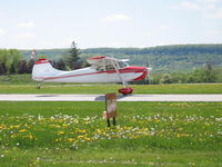
(http://www.avweb.com/eletter/archives/a ... tml#199198)Jerry Smith, regional sales manager for the Garmin's aviation division in the south and central U.S., died on Tuesday in an accident, while piloting his personal airplane on business. Smith was flying his Cessna Cardinal 177 when he crashed near Rich Mountain, in Mena, Ark. He was a commercial pilot with instrument, multi-engine and instructor (CFII and MEI) ratings, and over 20,000 hours of flight time. He was well-known in the industry, with over 40 years of experience. He had been with Garmin since 1994, where he was one of the first aviation sales managers hired by the company. Previously, he worked at BF Goodrich Aerospace, where he did research flying for Stormscope, as well as TCAS, King Radio, and others. "Beyond his professional contributions, even more sorely missed will be his zest for life and sense of humor, which everyone will remember," Garmin said in a news release. "Our thoughts and prayers are with Jerry's family, friends, co-workers and customers as their lives have been changed forever by this tragic event." The cause is still unknown, Garmin said on Wednesday, but the NTSB and FAA are investigating and Garmin has offered its full support.
CLICK ON PIC TO ENLARGE
GARMIN SALES MANAGER KILLED IN AIRPLANE ACCIDENT
Moderators: GAHorn, Karl Towle, Bruce Fenstermacher
-
GAHorn

- Posts: 21294
- Joined: Fri Apr 12, 2002 8:45 pm
GARMIN SALES MANAGER KILLED IN AIRPLANE ACCIDENT
You do not have the required permissions to view the files attached to this post.
'53 B-model N146YS SN:25713
50th Anniversary of Flight Model. Winner-Best Original 170B, 100th Anniversary of Flight Convention.
An originality nut (mostly) for the right reasons.
50th Anniversary of Flight Model. Winner-Best Original 170B, 100th Anniversary of Flight Convention.
An originality nut (mostly) for the right reasons.
-
wingnut
- Posts: 990
- Joined: Fri Dec 15, 2006 7:58 pm
Re: GARMIN SALES MANAGER KILLED IN AIRPLANE ACCIDENT
This happened 3 miles north of my house. Same place a Sierra went in about a year and a half ago. The Sierra was scud running highway 270 between Rich and Blackfork Mtns when visibility got bad. They tried a climbing turn to the south and didn't make it. A Beech 1900 went in on Forche Mtn a few years back. Experienced pilots
Del Lehmann
Mena, Arkansas
Mena, Arkansas
-
GAHorn
- Posts: 21294
- Joined: Fri Apr 12, 2002 8:45 pm
Re: GARMIN SALES MANAGER KILLED IN AIRPLANE ACCIDENT
Del, what is the radial/distance from the VOR to your house? (or lat/long, Prince Albert can* nailed to a tree, whatever....(grin)
*For those of you not Arkansas natives ... (I was born in Hot Springs)... many of the old land deeds used to be delineated by a Prince Albert tobacco can nailed to a tree at one corner, with a note stuck inside it describing the land claim/deed by either metes and bounds, piles of rocks, or description of landmarks. Arkansas law still recognizes the legality of such.)
*For those of you not Arkansas natives ... (I was born in Hot Springs)... many of the old land deeds used to be delineated by a Prince Albert tobacco can nailed to a tree at one corner, with a note stuck inside it describing the land claim/deed by either metes and bounds, piles of rocks, or description of landmarks. Arkansas law still recognizes the legality of such.)
'53 B-model N146YS SN:25713
50th Anniversary of Flight Model. Winner-Best Original 170B, 100th Anniversary of Flight Convention.
An originality nut (mostly) for the right reasons.
50th Anniversary of Flight Model. Winner-Best Original 170B, 100th Anniversary of Flight Convention.
An originality nut (mostly) for the right reasons.
-
Brad Brady

- Posts: 745
- Joined: Fri Feb 29, 2008 2:54 am
Re: GARMIN SALES MANAGER KILLED IN AIRPLANE ACCIDENT
thats cuz its Arkanasas.......(GRIN)gahorn wrote:Del, what is the radial/distance from the VOR to your house? (or lat/long, Prince Albert can* nailed to a tree, whatever....(grin)
*For those of you not Arkansas natives ... (I was born in Hot Springs)... many of the old land deeds used to be delineated by a Prince Albert tobacco can nailed to a tree at one corner, with a note stuck inside it describing the land claim/deed by either metes and bounds, piles of rocks, or description of landmarks. Arkansas law still recognizes the legality of such.)
-
170C

- Posts: 3182
- Joined: Tue May 06, 2003 11:59 am
Re: GARMIN SALES MANAGER KILLED IN AIRPLANE ACCIDENT
Not to minimize the tragic loss of this fellow pilot, and our condolences to his family and friends, unfortunately a lot of us have done scud running and managed to get away with it (and NO it wasn't/isn't the wise thing to do). On a lighter note George, NOW we understand why you are how you are---being born in Arkansas and all  And you even have all your teeth
  Now Jamie isn't your cousin is she
OLE POKEY
170C
Director:
2012-2018
170C
Director:
2012-2018
-
hilltop170
- Posts: 3485
- Joined: Sat May 06, 2006 6:05 pm
Re: GARMIN SALES MANAGER KILLED IN AIRPLANE ACCIDENT
I had just pulled up the ILS and GPS approach plates for Mena, Arkansas, KMEZ, right before I opened up the 170 website and saw this post. Paul Wood and I are flying to Mena tomorrow morning and it's possible we might have to file to get into Mena. I thought about Rich Mountain VOR while planning the flight and remembered the Convair crash years ago. This post is a good reminder about the risks of scud running in that area.
One other point to consider when flying in that area, Rich Mountain is not just a peak, it's a ridge many miles long and it's not the only one in that area, there are several other ridges as well as many other hills and mountains. They come up right out of flat land and are very deceiving. Minimum enroute altitude in the area is 4200'msl.
One other point to consider when flying in that area, Rich Mountain is not just a peak, it's a ridge many miles long and it's not the only one in that area, there are several other ridges as well as many other hills and mountains. They come up right out of flat land and are very deceiving. Minimum enroute altitude in the area is 4200'msl.
Richard Pulley
2014-2016 TIC170A Past President
1951 170A, N1715D, s/n 20158, O-300D
2023 Best Original 170A at Sault Ste. Marie
Owned from 1973 to 1984.
Bought again in 2006 after 22 years.
It's not for sale!
2014-2016 TIC170A Past President
1951 170A, N1715D, s/n 20158, O-300D
2023 Best Original 170A at Sault Ste. Marie
Owned from 1973 to 1984.
Bought again in 2006 after 22 years.
It's not for sale!
-
wingnut
- Posts: 990
- Joined: Fri Dec 15, 2006 7:58 pm
Re: GARMIN SALES MANAGER KILLED IN AIRPLANE ACCIDENT
gahorn wrote:Del, what is the radial/distance from the VOR to your house? (or lat/long, Prince Albert can* nailed to a tree, whatever....(grin)
*For those of you not Arkansas natives ... (I was born in Hot Springs)... many of the old land deeds used to be delineated by a Prince Albert tobacco can nailed to a tree at one corner, with a note stuck inside it describing the land claim/deed by either metes and bounds, piles of rocks, or description of landmarks. Arkansas law still recognizes the legality of such.)
about 100 degrees/14 miles. The VOR was called the Page VOR, for nearby Page OK. The Convair crashed into the east end of Blackfork Mountain, just about 2 miles north of Rich Mountain. It was shortly after that crash, the VOR was re-named and also our airport to Intermountain Regional.
Del Lehmann
Mena, Arkansas
Mena, Arkansas
-
wingnut
- Posts: 990
- Joined: Fri Dec 15, 2006 7:58 pm
Re: GARMIN SALES MANAGER KILLED IN AIRPLANE ACCIDENT
That's why all our women have one leg longer than the otherhilltop170 wrote:
One other point to consider when flying in that area, Rich Mountain is not just a peak, it's a ridge many miles long and it's not the only one in that area, there are several other ridges as well as many other hills and mountains.
Del Lehmann
Mena, Arkansas
Mena, Arkansas
-
GAHorn
- Posts: 21294
- Joined: Fri Apr 12, 2002 8:45 pm
Re: GARMIN SALES MANAGER KILLED IN AIRPLANE ACCIDENT
THAT'S RIGHT! When I first made the post I started to say it was POGE VOR....(with an "O")... and then I thought, "naw..that's not it... "... Anyway, I had a dim memory of the VOR's previous name but for some reason couldn't quite pull it out of the archives...and ultimately decided I must have imagined it had a completely different name. (the real point of the story being that they added the word "Mountain" to bring it to everyone's attention..... (Funny thing, Del... you don't look old enough to remember that crash. When I first pulled up to your hangar I had a momentary concern that you were old enough to have any real sheet metal experience.)wingnut wrote:... The VOR was called the Page VOR, for nearby Page OK. The Convair crashed into the east end of Blackfork Mountain, just about 2 miles north of Rich Mountain. It was shortly after that crash, the VOR was re-named and also our airport to Intermountain Regional.
(Everyone: of course the concerns were rapidly alleviated.)
'53 B-model N146YS SN:25713
50th Anniversary of Flight Model. Winner-Best Original 170B, 100th Anniversary of Flight Convention.
An originality nut (mostly) for the right reasons.
50th Anniversary of Flight Model. Winner-Best Original 170B, 100th Anniversary of Flight Convention.
An originality nut (mostly) for the right reasons.
-
wingnut
- Posts: 990
- Joined: Fri Dec 15, 2006 7:58 pm
Re: GARMIN SALES MANAGER KILLED IN AIRPLANE ACCIDENT
That Convair crash was in a designated wilderness area and is still there. You can see the wilderness area boundery northeast of the VOR on the chart George posted. The link below is a website that has the story and pictures of what remains up there.
http://okwreckchasing.org/ti655.html
http://okwreckchasing.org/ti655.html
Del Lehmann
Mena, Arkansas
Mena, Arkansas
-
Bruce Fenstermacher

- Posts: 10420
- Joined: Tue Apr 23, 2002 11:24 am
Re: GARMIN SALES MANAGER KILLED IN AIRPLANE ACCIDENT
I find it amazing that a guy with presumably the best Garmin equipment, to include terrain awareness, still flies into the ground.
I'm at a loss for more thought on the subject.
I'm at a loss for more thought on the subject.
CAUTION - My forum posts may be worth what you paid for them!
Bruce Fenstermacher, Past President, TIC170A
Email: brucefenster at gmail.com
Bruce Fenstermacher, Past President, TIC170A
Email: brucefenster at gmail.com
-
4stripes
- Posts: 143
- Joined: Fri Sep 17, 2004 10:02 am
Re: GARMIN SALES MANAGER KILLED IN AIRPLANE ACCIDENT
Planes crash for all kinds of reasons. Weather is just one of them. It's best not to speculate untill the report (if any) is made.
-
Robert Eilers
- Posts: 652
- Joined: Sat May 08, 2004 12:33 am
Re: GARMIN SALES MANAGER KILLED IN AIRPLANE ACCIDENT
About 15 years ago, while I was managing our Office of Emergency Services, I had the opportunity to conduct a study of controlled flight into terrain accidents in what we call the Tri-Valley area. The Tri-Valley area during the early Winter months is plagued by a Marine Layer with bases averaging 800-1000 ft with tops generally around 2500 ft. There is an airport located in the Tri-Valley area a valley. Also, once though the Eastern pass into the valley another Western pass allows access into the Bay Area West of the Oakland hills. I researched the NTSB reports for the previous twenty years. The result was shot gun type patterns of CFIT crashes around all four passes.
"You have to learn how to fall before you learn how to fly"
-
voorheesh
- Posts: 603
- Joined: Tue Jan 04, 2005 5:22 am
Re: GARMIN SALES MANAGER KILLED IN AIRPLANE ACCIDENT
It sounds like you are talking about Altamont Pass from Tracy to Livermore (east) and the pass from Dublin to Castro Valley (west). In summer months there is a marine layer from the SF Bay that can be drawn east up to Altamont Pass by the thermal low over the central valley. Temps in the valley as high as 105 and 50 miles west it is 50. In the winter, the opposite happens: We get cold moist air stratus/tule fog over the valley and warmer air at the coast. This difference will result in a westerly flow and the stuff will come over Altamont and around Mt Diablo and sock in the valley from Livermore to Martinez. It is suicidal to attempt to fly VFR through these passes when the clouds are low. We can also get thick bay fog at the same time which socks in the Bay area airports. Half Moon Bay can be your best bet when this happens. California is a state where the weather is usually so good that pilots get suckered into flying into deteriorating conditions and get in trouble. We had two really bad accidents down here near Fresno this past Thxgiving weekend. One tried to land at Harris Ranch (socked in) and as he climbed out ran the right tank of his Bonanza dry. Crashed a mile short of New Coalinga & rear seat passenger died. Another Bonanza (G1000 equiped) hit 15' high trees short of runway 30 at Porterville while attempting a GPS approach when the vis was 1/2 mile. No fatalities but 3 with critical injuries. The weather on both days was typical: afternoon haze followed by rapidly developing fog after dark.
I used to fly Embraer Bandeirantes into Junior Goodner's paint shop at Mena, AR back in the 80s and the sectional chart at the time had a note: "High Accident Area". That kind of got your attention when a front came through and everything started dropping. Maybe we need a note like that over California's sectionals.
I used to fly Embraer Bandeirantes into Junior Goodner's paint shop at Mena, AR back in the 80s and the sectional chart at the time had a note: "High Accident Area". That kind of got your attention when a front came through and everything started dropping. Maybe we need a note like that over California's sectionals.
-
GAHorn
- Posts: 21294
- Joined: Fri Apr 12, 2002 8:45 pm
Re: GARMIN SALES MANAGER KILLED IN AIRPLANE ACCIDENT
The list of aircraft crashes at Rich Mountain area is extensive:
5 March 1936 Beechcraft B17L Staggerwing NC15486 2/2 Crashed onto Rich Mountain in fog and burned
10 December 1943 Douglas RA-24A 42-6706 2/2 Crashed onto Fourche Mountain in fog
28 February 1945 Beech AT-17C 43-49982 3/5 Crashed onto Rich Mountain in bad weather
31 October 1945 Douglas R4D-7 99834 14/14 Crashed onto Rich Mountain in bad weather
10 April 1949 "Single Engine" unknown 0/4 Crashed onto Rich Mountain in bad weather
14 November 1950 Navy R4D? unknown 6/6 Crashed onto Rich Mountain in bad weather
5 February 1951 North American T-6D 42-84311 1/1 Crashed onto Rich Mountain in bad weather
7 October 1961 "Light Plane" unknown 2/2 Crashed onto Black Fork Mountain
29 April 1967 Cessna T-41 67-15141 2/2 Crashed onto Rich Mountain in bad weather
26 January 1968 Mooney M20 N5225B 4/4 Crashed onto Rich Mountain in bad weather
11 November 1969 Cessna 172 N7180T 1/1 Crashed onto Rich Mountain in bad weather
28 December 1972 Piper PA-28 Cherokee N4899T 2/2 Crashed onto Rich Mountain in bad weather
30 April 1973 Cessna 172 N20318 3/3 Crashed onto Brush Heap Mountain in bad weather
27 September 1973 Convair 600 (240D) N94230 11/11 Texas International Flight 655 - CFIT in IMC
13 March 1975 Bellanca 17-30 Viking 300 N4930V 4/4 Crashed onto Rich Mountain in bad weather
20 February 1976 Piper PA-24 Commanche N6396P 1/1 Crashed onto Rattlesnake Mountain
2 December 1983 Cessna 310K N310JD 1/1 Crashed onto Rich Mountain
15 February 1984 Cessna 414A N6815Z 2/2 Crashed onto Rich Mountain in IMC
20 February 1985 Piper PA-34-200T Seneca II N8658E 1/1 Crashed onto Fourche Mountain during IFR approach
22 April 1985 Cessna 310G N8942Z 2/2 Crashed onto Rich Mountain after structural failure
15 November 1987 Piper PA-28-180 Cherokee N9131J 1/1 Crashed onto Fourche Mountain in IMC
15 March 1993 Piper PA-23-160 Apache N4341P 0/3 Crashed into terrain 12 mi NW due to airframe icing at night
9 December 2002 Beechcraft 1900C N120YV 3/3 Crashed onto Fourche Mountain in bad weather
15 December 2003 Beechcraft H35 Bonanza N7929D 1/1 Crashed into north face of mountain during VFR Approach
21 March 2006 Beech C23 Sundowner N2160W 1/2 Crashed onto Rich Mountain in fog
11 November 2008 Cessna 177RG Cardinal N2526V 1/1 Crashed onto Rich Mountain
'53 B-model N146YS SN:25713
50th Anniversary of Flight Model. Winner-Best Original 170B, 100th Anniversary of Flight Convention.
An originality nut (mostly) for the right reasons.
50th Anniversary of Flight Model. Winner-Best Original 170B, 100th Anniversary of Flight Convention.
An originality nut (mostly) for the right reasons.
Cessna® is a registered trademark of Textron Aviation, Inc. The International Cessna® 170 Association is an independent owners/operators association dedicated to C170 aircraft and early O-300-powered C172s. We are not affiliated with Cessna® or Textron Aviation, Inc. in any way.